3D routes map for UAVs to be drawn up
3D routes map for UAVs to be drawn up
Posted July. 22, 2016 07:09,
Updated July. 22, 2016 07:29
The map is expected to promote safer flight for drones by helping them detect potential obstacles more quickly such as transmission towers, utility poles, and high-tension wires. “We are facing an increasing demand for a routes map for drones amid the growing interest in new industries such as drone-delivery service,” the ministry said, explaining on the necessity of the map.
Currently, two-dimensional maps are being used for drones’ flight. The ministry explained that the discrepancy between the two dimensional information of the existent maps and the three dimensional space where the actual flights take place has long posed a great risk of accidents. In fact, it is very common for drones to get caught by utility wires or run into a building, not only in Korea but also in other countries.
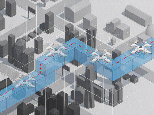
The drones’ route map will contain three dimensional data including information on space, such as the heights of land and buildings, as well as information on obstacles that interrupt drones’ flight. This includes various types of information -- information on obstacles and flying zones; meteorological data such as temperature, wind, humidity and fine dust levels; geological data such as soil and ground types; information on basement facilities such as waterworks & sewerage, electric power, telecommunications; maritime data such as ocean temperature, salinity, and currents.
The land ministry is planning to launch a pilot project in parts of Jeonju and Yeongwol to establish three dimensional space data among the five cities (Busan, Daegu, Jeonju, Yeongwol, Goheung) designated as airspace in the pilot project to verify the safety of drones late last year. As a part of such effort, the ministry conducted test flights in Jeonju last Friday to secure obstacle data and identify the factors that undermine the safety of automated navigation, and it plans to start drone delivery service in Jeonju and Yeongwol as a demonstration case as early as in late this year.
While agreed to the necessity of gathering such data for aerial safety, experts are voicing their concerns that opening up the routes could turn into imposing regulation. “In Korea, advancement of drones has been stunted by a host of restrictions such as the characteristic of the peninsular as a divided nation, traffic laws, and aviation laws,” said Park Jae-heung, a professor of the department of UAV at Daeheung University. “If we were to follow the routes established by the government only, the scope of application will be limited to drone delivery services.”
“The initiative is in large part driven by the goal of encouraging industry drones. A discussion for deregulation on drone flights is also underway,” said an official from the land ministry.
구가인기자 comedy9@donga.com